
Deep in the northern boreal forests of Maine, standing completely isolated like an ancient stone fortress, rises Mount Katahdin. To the Penobscot people who revered this granite monolith for millenia, Katahdin translates simply as “The Greatest Mountain.” To the battle-hardened community of long-distance thru-hikers, it represents something even more profound: the ultimate finish line of the 2,190-mile Appalachian Trail.
By the time a northbound (NOBO) thru-hiker reaches the foot of Katahdin in Baxter State Park, they have walked through fourteen states, climbed over 464,000 feet of cumulative elevation gain, endured freezing hypothermic rains in the Great Smoky Mountains, and survived the treacherous roots and boulder fields of the Hundred-Mile Wilderness.
Ahead of them lies the final, staggering 4,000-foot vertical scramble up the Hunt Trail, the dizzying drop-offs of the legendary Knife Edge, and the most sacred timber signpost in American backpacking: the weathered summit marker atop Baxter Peak (elevation 5,268 feet).
Whether you are planning your own Appalachian Trail expedition, dreaming of section-hiking Maine’s rugged high country, or celebrating a friend’s thru-hike completion, here is our comprehensive field guide to Mount Katahdin, the iconic Knife Edge traverse, thru-hiker culture, and the durable heavyweight tees built for life beyond the trail.
Wilderness First, Visitors Second
Governor Percival Baxter deeded 209,644 acres of pristine Maine wilderness with a strict covenant: “Forever Wild.” Unlike commercial national parks, Baxter State Park has no paved roads, no running water at trailheads, no electricity, and no cell service. Hikers must carry complete self-reliance in their packs.
1. The Ascent to Baxter Peak: Scrambling the Hunt Trail
The official Appalachian Trail reaches its terminus via the Hunt Trail, a grueling 5.2-mile one-way ascent from Katahdin Stream Campground that gains over 4,188 feet of elevation.
1.1. The Bouldering Crucible Above Treeline
The lower two miles meander along rushing mountain cascades and through dense spruce-fir boreal woods. But once you cross the treeline at approximately 3,200 feet, the trail turns into an intense, full-body Class 3 rock scramble. Hikers must pull themselves up massive granite boulders using steel rungs bolted directly into the rock face.
1.2. The Tableland to the Summit
Emerging over the Gateway ridge onto the Tableland—a windswept arctic alpine plateau of tundra grasses and lichen-encrusted granite—the temperature routinely plunges 20 to 30 degrees. The final mile gently rises across the plateau until the timber silhouette of Baxter Peak appears against the horizon.
“A mountain footpath for those who seek fellowship with the wilderness.” — Benton MacKaye, Visionary of the Appalachian Trail
2. The Knife Edge: Walking the Razor’s Edge of Maine
No discussion of Katahdin is complete without the Knife Edge Trail. Stretching 1.1 miles between Baxter Peak and Pamola Peak, this serrated granite arête is one of the most exhilarating and perilous trail traverses in the Eastern United States.
At its narrowest points, the path shrinks to less than three feet wide, with sheer, near-vertical thousand-foot drop-offs tumbling into Chimney Pond on one side and the South Basin on the other. Park rangers issue stern warnings: Never attempt the Knife Edge in high winds, rain, or approaching thunderstorms. On calm, crystalline autumn mornings, however, it offers an unmatched panoramic view across the endless unbroken forest canopy of northern Maine.
3. The Sacred Timber: Touching the Baxter Peak Signpost
For a thru-hiker who has spent five to seven months following 2×6-inch white blazes from Springer Mountain, Georgia, summiting Baxter Peak is a deeply emotional, life-defining milestone.
Hikers lay their battered trekking poles against the rocks, weep openly, embrace trail companions who shared shelter floors and freeze-dried dinners, and place their hands on the iconic wooden summit sign. The inscription has remained unchanged for generations:
ELEVATION 5,268 FEET
NORTHERN TERMINUS OF THE APPALACHIAN TRAIL
A MOUNTAIN FOOTPATH EXTENDING 2,190+ MILES TO SPRINGER MOUNTAIN, GEORGIA
4. Rust & Roam’s Appalachian Trail Collection
At Rust & Roam Co., our trail apparel is designed to celebrate the perseverance, blisters, and brotherhood of the long-distance hiking community. Discover our top-rated pieces from the Appalachian & Thru-Hikers Collection:
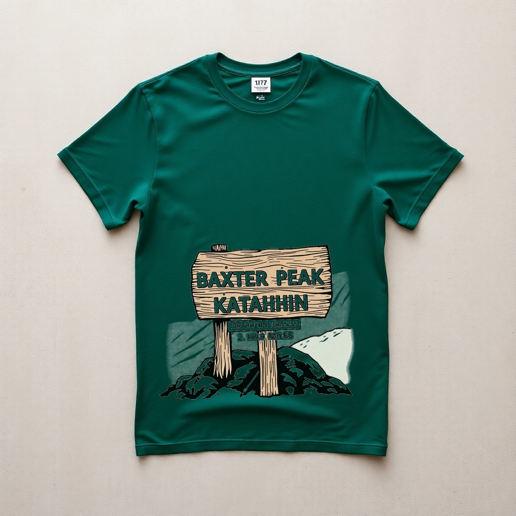
Katahdin Northern Terminus 2190 Miles Tee
Vintage Wash CC 1717 • $34.00
Featuring the iconic Baxter Peak timber signpost, white blazes, and 2,190-mile trail laurels.
Shenandoah Blue Ridge Mist Hiker Tee
Heavyweight Ring-Spun • $34.00
Celebrating Skyline Drive, Old Rag Mountain, and the rolling blue ridges of Virginia.
Glacier Mountain Goat Heritage Tee
Garment-Dyed Cotton • $34.00
Honoring Logan Pass, highline alpine scrambles, and the sovereign climber of Montana.
All 63 National Parks Postage Stamp Tee
Vintage Wash CC 1717 • $34.00
A complete postal tribute capturing every US national park from Acadia to Zion.
5. Why 6.1 oz Cotton Is the Thru-Hiker’s Post-Trail Salvation
When you spend months living out of a lightweight backpack, every gram counts. You live in ultralight, moisture-wicking synthetic polyester that quickly becomes foul-smelling, static-prone, and scratchy against sun-burned skin.
The greatest sensory luxury for any hiker stepping off Katahdin into the trail town of Millinocket is peeling off synthetic gear and pulling on a fresh, 6.1 oz heavyweight ring-spun cotton tee:
- Substantial Velvety Hand: Comfort Colors 1717 blanks are pre-washed and garment-dyed, giving them a broken-in softness that feels comforting against tired muscles.
- Campfire Ember Resistance: Unlike nylon fleece that melts instantaneously when a spark pops from a celebratory bonfire, dense 100% ring-spun cotton naturally resists embers.
- Boxy Structured Fit: The relaxed tubular construction skims comfortably over lean, post-hike frames without clinging. For comparison with lightweight blanks, see our guide on Comfort Colors 1717 vs. Bella+Canvas 3001.
6. Frequently Asked Questions (FAQ)
Can day hikers climb Mount Katahdin without hiking the whole Appalachian Trail?
Yes! Day hikers climb Katahdin regularly, but you must secure a mandatory Baxter State Park Day Use Parking Reservation (DUSR) in advance during peak summer months. It is an extremely strenuous 8 to 12-hour round-trip hike requiring at least three to four liters of water, proper footwear, and cold-weather layers even in mid-July.
When does Mount Katahdin close for the winter hiking season?
Baxter State Park officials generally close the trails to Katahdin’s summit around October 15 to 22 each year, or earlier if early blizzards blanket the Tableland in ice. Thru-hikers must reach Baxter Peak before the official closing date to complete their journey.
Where can I read more about the Appalachian Trail white blaze tradition?
To dive deeper into the trail culture, shelters, and legendary 2,190-mile footpath, explore our companion field guide: Chasing White Blazes: The Thru-Hiker’s Field Guide to the Appalachian Trail.
Commemorate the 2,190-Mile Journey
Explore our authentic Appalachian Trail and backcountry hiking graphic tees printed on durable Comfort Colors 1717 blanks.
Written by The Rust & Roam Editorial Team
Born out of dusty backroads, early dawn river casts, and crackling pine embers. We obsess over heavyweight Americana blanks, breathable water-based inks, and timeless heritage gear that wears in, not out.